

Партнерка на США и Канаду по недвижимости, выплаты в крипто
- 30% recurring commission
- Выплаты в USDT
- Вывод каждую неделю
- Комиссия до 5 лет за каждого referral
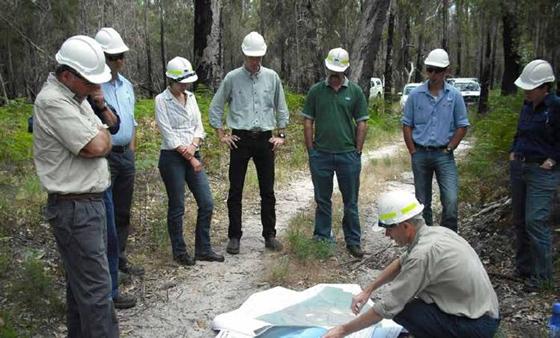
Picture caption: Water authorities’ field day © DELWP
Communities
Map 4 shows 15 of our landscape’s higher-risk communities. The code of practice prioritises minimising the impact of bushfires on human life over all other considerations. We assessed the 15 communities shown on the map as at higher risk of more-frequent or more-damaging fires.
The location of many communities in the landscape exposes them to bushfire risk. In 2011, about 84 000 people, or 2% of Victoria’s population, lived in our landscape. Of this population, 38% lived in small towns and settlements with less than 500 people in rural and coastal settings. Many of the small settlements are at increased bushfire risk from nearby forested land.
Some communities and groups of people are more vulnerable to bushfires than others, including those who lack experience of bushfire, summer visitors, people with disabilities or illness, the elderly and people from non-English-speaking backgrounds. These people and communities in particular tend to be less-aware of bushfire risks, less prepared for bushfire, and less able to quickly respond to it. These factors can also compromise evacuation and firefighting efforts. Small town populations in this landscape are declining, and their average ages (and thus the number of people needing help during bushfires) are increasing. An ageing and declining population also means there are fewer and less-able-bodied volunteers to fight fires on private land.
We measure risk to life and property by modelling dwelling loss, one component of how we prioritise zone placement, according to the relative risk that properties face from bushfire.
To protect our priority communities, we:
· place asset protection zones close to communities so we intensively manage fuel
· place asset protection zones or bushfire moderation zones close to communities, to slow the spread of bushfires before they reach communities, and to reduce ember attack on properties
· place bushfire moderation zones where bushfires that might threaten communities are most likely to originate and intensify.
Infrastructure
Map 4 shows two of the landscape’s priority infrastructure assets: a section of the Princes Highway and the water supply catchments. Other priority infrastructure asset categories include communications and utility infrastructure.
The Princes Highway is the main freight route for produce into and out of Gippsland, and there are few alternative routes for heavy vehicles (which comprise 20% of all traffic along this highway). There is a 50% increase in traffic volumes along the highway in busy holiday periods, with peak traffic over the summer holiday.
The water supply catchments are vulnerable to bushfires. They can damage water supply infrastructure and contaminate the water with ash and other debris. In some areas in the catchments, post-bushfire landslides of water and debris can do further damage, and degrade water quality.
Electricity and telecommunications infrastructure is essential for bushfire response, including to disseminate emergency information to communities. Electricity is essential for pumping water, for air conditioning and for other basic services, especially for vulnerable people and even more so if they are in remote locations.
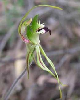
Picture caption: Greencomb spider-orchid © Faye Bedford DELWP
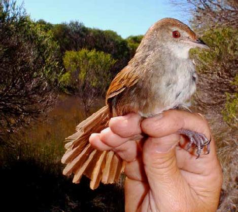
Picture caption: Eastern bristlebird © DELWP
We prioritise this infrastructure for protection to ensure, in the event of a bushfire, there is minimal disruption to essential services, and that post-bushfire recovery works are not impeded. Identifying priority infrastructure also helps us keep in touch with owners during a bushfire.
To protect our priority infrastructure, we:
· place fire management zones that indirectly protect communities by protecting priority infrastructure
· work with the infrastructure owners and managers to help them implement their fire protection plans
· ensure planned burning does not disrupt or damage high-voltage transmission lines (the dense particles in smoke can arc electricity between the lines, potentially shorting them).
Public administration facilities
We prioritise public administration facilities to minimise disruptions to emergency management services in the event of a bushfire, and to minimise impediments to recovery works after a bushfire.
We prioritise administration facilities (such as government and shire offices), emergency facilities (such as incident control centres, fire stations and police stations) and emergency infrastructure (such as firefighting airbases, communications / radio towers and fire-spotting towers).
Environment
Map 4 shows the landscape’s fire-sensitive listed vegetation communities, and priority plant and animal habitat. We prioritise these environmental assets if they have conservation importance for Victoria or Australia, if fire is likely to change them, and if they can be managed at a landscape level.
We prioritise fire-sensitive listed vegetation communities because an intense bushfire can have severe and long-term ecological effects on them: it can alter the composition and structure of their vegetation, fragment them and make them susceptible to invasion by exotic species. Across the landscape, there are 29 100 ha of these communities, which are listed as important under state or federal legislation. These communities are often in small isolated patches and include Alpine sphagnum bogs and associated fens, littoral rainforest and coastal vine thickets, warm temperate rainforest and Alpine snowpatch.
We also prioritise the habitat of 17 plant and 26 animal species that are vulnerable to fire and of conservation or social concern within the landscape. Bushfires can affect these species in many ways including by reducing the availability of these species’ food, causing their populations to decline and destroying components of critical habitat. Species that occur in small, isolated populations are particularly vulnerable to bushfires and include the Brush-tailed rock wallaby, Eastern bristlebird, Wellington mint-bush and Colquhoun grevillea.
To protect our priority environmental assets, we:
· through fire management zoning, minimise the impacts of planned burning on them, while protecting other priority assets
· identify and retain environmental values (such as some areas of long-undisturbed vegetation) important for ecosystem resilience
· incorporate the requirements of environmental values when doing planned burning or other fuel management activities
· identify potential conflicts between our intended planned burning and environmental values.
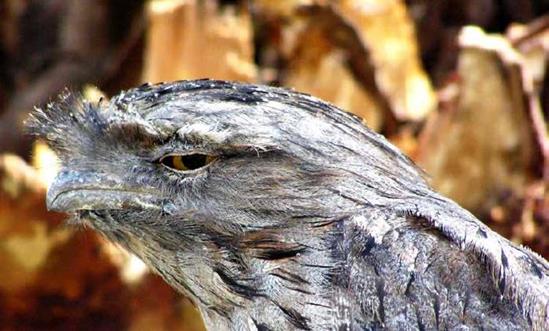
Picture caption: Tawny frogmouth © Faye Bedford DELWP
Economy
We prioritise the landscape’s tourism industry because it contributes over $450 million annually, and accounts for more than 2400 jobs in the Wellington and East Gippsland shires. Bushfires put the industry at risk: they damage or destroy the natural environments and infrastructure on which the industry relies, and most tourists visit from December to April.
Bushfires can harm the timber, agriculture, apiary, horticulture and viticulture industries: they destroy and damage buildings, fencing, machinery and equipment, and kill and injure livestock. Bushfires impact the apiary industry and threaten food security, by damaging native and productive plants such as fruit trees and grape vines. The viticulture industry is particularly vulnerable to smoke taint during the summer bushfire season.
To protect our priority economic assets, we:
· place zones to help reduce risk to them, while protecting other priority assets
· work in partnership with owners of plantations and private land managers as they implement their own fuel management strategies.
Cultural heritage and social assets
The public land within our landscape has a long and complex Aboriginal and non-Aboriginal history.
The landscape’s Aboriginal cultural heritage stretches back thousands of generations and includes the use of fire by Aboriginal people for environmental, economic and social purposes. The landscape today has over 9500 registered Aboriginal cultural heritage sites including ceremonial gathering places, shell middens, burial sites, scar trees and artefact scatters. It is likely there are many more undiscovered sites.
There is one registered Aboriginal party in the landscape: the Gunaikurnai Land and Waters Aboriginal Corporation. A large part of the landscape is formally recognised as the traditional land of the Gunaikurnai people, and DELWP and PV jointly manage 10 parks and reserves with the Traditional Owner Land Management Board. We will continue to work with these groups to ensure the best possible protection of our cultural heritage.
The landscape’s non-Aboriginal cultural heritage includes over 170 years of mining, water and timber harvesting, grazing and recreation.
We prioritised community meeting places as they are important for community connectivity. Some are places of last resort in a bushfire emergency.
To protect our priority cultural heritage and social assets, we:
· protect known cultural heritage sites from disturbance when we manage fuel, and when we suppress bushfires
· protect unknown cultural heritage sites during all our activities, by watching for unidentified sites; only a very small percentage of Victoria’s area has been formally assessed for Aboriginal cultural heritage.
How we will protect our landscape
Our fuel management strategy
About our fuel management strategy
Map 5 shows the landscape’s fuel management strategy. The strategy comprises:

|
Из за большого объема этот материал размещен на нескольких страницах:
1 2 3 4 5 6 |
