
Партнерка на США и Канаду по недвижимости, выплаты в крипто
- 30% recurring commission
- Выплаты в USDT
- Вывод каждую неделю
- Комиссия до 5 лет за каждого referral
ЛИНГВОСТРАНОВЕДЕНИЕ США
Учебное пособие
Изд-во АлтГТУ
Барнаул 2013
ББК К795
Лингвострановедение США:
Учебное пособие. Кремнева
– Барнас.
Учебное пособие предназначено для использования на занятиях по курсу «Лингвострановедение» и содержит материалы страноведческого характера, которые знакомят студентов с географией, историей, экономикой, государственным устройством и культурой США. Пособие состоит из 16 разделов, каждый из которых содержит основные тексты, снабженные заданиями для проверки понимания прочитанного, а также развития навыков говорения и аудирования. К учебному пособию прилагается CD, что позволяет выполнить целый ряд заданий, направленных на развитие навыков аудирования.
Пособие предназначено для студентов старших курсов языковых специальностей, оно также может быть использовано аспирантами и широким кругом лиц, изучающих историю и культуру США. Структура и содержание учебного пособия соответствуют образовательному стандарту высшего профессионального образования по курсу «Лингвострановедение».
Рецензенты:
доктор филологических наук, профессор АлтГПА
кандидат исторических наук, профессор АлтГТУ
CONTENTS
UNIT 1
Part I Geography………………………………………………………………………5
Part II American Regionalism……………………………………………………….14
UNIT 2
Part I First Explorers from Europe…………………………………………………..23
Part II Early British Settlements……………………………………………………..27
Part III Puritan New England ……………………………………………………….30
UNIT 3 Colonial Period……………………………………………………………..41
UNIT 4 The Independence War……………………………………………………..50
UNIT 5
Part I The Westward Movement……………………………………………………..62
Part II A Divided Nation ……………………………………………………………66
UNIT 6
Part I The Civil War…………………………………………………………………72
Part II American Reconstruction………………………………………………….…77
UNIT 7
Part I Miners, Railroads and Cattlemen……………………………………………...83
Part II The Age of Big Business……………………………………………………..87
UNIT 8
Part I The American Empire…………………………………………………………98
Part II America in World War I…………………………………………………….102
Part III America in the 1920s………………………………………………………106
UNIT 9
Part I The Great Depression and the New Deal…………………………………….111
Part II America in World War II……………………………………………...……116
UNIT 10
Part I The Cold War……………………………………………………………...…125
Part II The New Frontier and the Civil Conflict……………………………………128
Part III The Vietnam War…………………………………………………………..134
UNIT 11
Part I America in the 1970s…………………...……………………………………145
Part II New Federalism……………………………………………………………..150
America in the 1990s……………………………………………………………….156
UNIT 12
Part I Government………………………………………………………………….161
Part II Political Parties and Elections………………………………………………177
UNIT 13 The Native American………………………………………………….…188
UNIT 14 Mass Media………………………………………………………………200
UNIT 15
Part I The System of Education…………………………………………………….214
Part II College and University……………………………………………………...223
UNIT 16 Sports and Games………………………………………………………...232
BIBLIOGRAPHY…………………………………………………………….……241
UNIT 1
PART I
GEOGRAPHY
Introduction
The United States of America occupies part of North America, borded by Canada to the north and Mexico to the south, and washed by the Atlantic Ocean to the east, the Gulf of Mexico to the south, and the Pacific Ocean to the west. This area contains 48 of the 50 American states, and is known as the coterminous United States. The other two states are Alaska at the northwestern tip of North America, and the island group of Hawaii in the central Pacific. Other outlying territories include Puerto Rico and the Virgin Islands of the United States in the Caribbean, the Guam, the American Samoa and the Trust Territory of the Pacific Islands.
In area, the United States is the forth-largest country in the world (behind Russia, Canada and China). In terms of economic, political and cultural influence it is one of the leading nations in the world. It owes its success to its plentiful natural resources, a rich cultural mix, and a strong sense of national identity. The dominant characteristic of the landscape of the United States is great diversity. The diversity stems from the fact that the country is so large and has so many kinds of land, climate and people. It stretches 2,575 kilometers from north to south, and 4,500 kilometers from east to west. It covers 9,372,614 square kilometers. The deep-green mountain forests are drenched with 250 centimeters of rain each year. At the other extreme, the deserts of the southwest receive less than 13 centimeters annually. A traveler from almost any other country can find parts of the United States that remind him of home. There are pine forests dotted with lakes, and mountain peaks covered with snow. There are meadows with brooks and trees, and sea cliffs, and wide grassy plains, and broad spreads of grapevines, and sandy beaches. The climate is similarly diverse, ranging from Arctic in northern Alaska to subtropical in the southeast; the warmest areas include both the arid heat of the Arizona deserts and the everglades of Florida.
The face of the land
Much of the geography and history of the United States was determined some 10,000 to 25,000 years ago. At that time, the great northern ice cap flowed over the North American Continent and ground into a number of major changes. These ice flows determined the size and drainage of the Great Lakes. They changed the direction of the Missouri River. They pushed soil a huge part of Canada into the United States, thus creating the northern part of the Central Agricultural Basin – one of the richest farming areas in the world.
On the Atlantic shore of the United States, much of the northern coast is rocky and uninviting, but the middle and southern Atlantic coast rises gently from the sea. It starts as low, wet ground and sandy flats, but then becomes a rolling coastal lowland. The Appalachians, which run parallel to the east coast, are old mountains with many coal-rich valleys between them. West of the Appalachians is the Great Central Lowland which resembles the plains of eastern Europe, or Manchuria, or the Great Plains of Australia.
North of the Central Lowland, extending for almost 1,600 kilometers, are the five Great Lakes (Lake Superior, Lake Michigan, Lake Ontario, Lake Huron, and Lake Erie), which the United States shares with Canada. The lakes are estimated to contain about half of the world’s fresh water. They are navigable by large ships via connecting canals, and are drained by the St. Lawrence Seaway. Located near the center of the continent, the lakes are stormier than most of the world’s oceans and merce on the Great Lakes has played an important role in the prosperous economic development of the Unites States.
West of the Central Lowland are the Great Plains, which cover one-fifth of the United States and extend from Texas in the south over 2,400 kilometers north to Canada. They are stopped by the Rocky Mountains, “the backbone of the continent”, which stretches from northern Mexico to Alaska. The Rockies are considered young mountains: of the same age as the Alps in Europe, the Himalayas in Asia, and the Andes in South America. Like these ranges they are high, rough and irregular in shape.
At first sight, the land west of the Rockies appears to be tumbled masses of mountains. Actually, however, it is made up of quite distinct and separate regions, shaped by different geological events. One region was formed by material which was washed down from the Rockies and pressed into rock. This now encompasses the high Colorado Plateau, extending with a remarkable landscape of mesas, buttes and canyons. The Grand Canyon of the Colorado River is just one of many national parks in this region. Another region, the Columbia Basin lies to the north. The rocks there are still being formed by a continuing upflow of lava that has buried old mountains and filled valleys. Volcanoes also built the Cascade Mountains. The Cascade Range extends from Washington through Oregon to Lassen Peak in California, and includes a chain of high volcanoes. The Sierra Nevada Range includes Mount Whitney (4418 m), and is cut by spectacular glacial valleys. At the border of the Pacific Ocean lie the Coastal Ranges, relatively low mountains, in a region where occasional earthquakes show that the process of mountain-building has not yet stopped. The highest peak of the USA is Mount McKinley (6193 m) which is located in Alaska.
The rivers
The Unites States is also a land of rivers and lakes. The northern state of Minnesota, for example, is known as the land of 10,000 lakes. One of the world’s greatest continental rivers, the Mississippi river, is the main arm of the great river system draining the area between the Appalachian and Rocky Mountains. The Mississippi is nicknamed the Nile of America, the Father of Waters as its waters are gathered from two-thirds of the United States. Through its lower course it wanders along, appearing lazy and harmless. But people who know the river are not deceived by its benign appearance, for they have had many struggles with its floods. The Mississippi has made a unique contribution to the history and literature of the United States. Mark Twain celebrated the life on the great river in the books “The Life in the Mississippi”, “Tom Sawyer”, “Huckleberry Finn”. As the central river of the United States the Mississippi has become one of the biggest commercial waterways in the world. Together with the Missouri (its chief western branch) it flows some 6,700 kilometers from its northern source in the Rocky Mountains to the Gulf of Mexico, which makes one of the world’s longest waterways.
The second longest river in the United States and once the most destructive one is the Missouri. When the first explorers reached the present city of St. Louis, they were amazed by the mighty stream of dirty water pouring down from the west. The French priest, who was leading the expedition, wrote: “I have seen nothing more frightful. A mass of large trees … real floating islands, came rushing… so that we could not, without great danger, expose ourselves to pass across”. That was the Missouri river in flood. The Missouri rises high among the snows of the Rocky Mountains and is really two rivers: one of water, and one of small bits of soil, washed off the land. The people who live along the Missouri’s banks say it is “too thin to plow and too thick to drink”. Time after time, the muddy waters of the Missouri flooded, spreading ruin and killing people. In 1944 the US government began a vast project called for a series of man-made lakes and dams to control the river. The Missouri is nicknamed the Big Muddy and where it pours into the Mississippi from the west, it colors its water deep brown with small pieces of soil. Farther downstream, where the clear waters of the principal eastern tributary, the Ohio, join the Mississippi, evidence of the difference between the dry west and rainy east becomes apparent. For kilometers the waters of the two rivers flow on side by side without mixing. Those from the west are brown; they have robbed the soil in areas of sparse vegetation. The waters from the east are clear and blue; they come from hills and valleys where plentiful forest and plant cover has kept the soil from being washed away.
Like the Mississippi, all the rivers east of the Rockies finally reach the Atlantic; all the waters to the west of the Rockies finally arrive at the Pacific. For this reason the crests of the Rocky Mountains are known as the Continental Divide. There are many places in the Rockies where a visitor may throw two snowballs in opposite directions and know that each will feed a different ocean.
The two great rivers of the Pacific side are the Colorado in the south, and the Columbia in the north. In the dry western country both rivers, very different in character, are vital sources of life. The Columbia, wild in prehistoric times, now flows with quiet dignity. But the Colorado is still a river of enormous fury – wild, restless and angry. But even the furious Colorado has been dammed and put to work. All the farms and cities of the southwest corner of the country depend on its waters.
The Rio Grande, about 3,200 kilometers long, is the foremost river of the Southwest. It flows from its sources in the southern Rocky Mountains to the Gulf of Mexico and forms a natural boundary between Mexico and the United States, which together have built irrigation and flood control systems of mutual benefit.
Natural resources
The United States is rich in most of the metals and minerals needed to supply its basic industries. The nation produces millions of tons of iron a year. Steel is vital to the manufacture of some 200,000 other products. Three quarters of the iron ore comes from the Lake Superior region of the Great Lakes.
Coal is the second major natural resource found in large quantities in the United States. There are sufficient reserves to last hundreds of years. Most of the coal is used by steam plants to produce electricity. Much coal is also used in chemical industries for the manufacture of plastics and other synthetics.
Oil wells in the United States produce more than 2 million barrels of petroleum a year. The production, processing and marketing of such petroleum products as gasoline and oil make up one of America’s largest industries. The Alaska pipeline stretches for 1,290 kilometers from the northern oil fields to a port on the south coast. Natural gas and manufactured gas furnish more than one-third of the nation’s power. Natural gas is carried by huge pipelines thousands of kilometers from oil and gas fields to heat homes and buildings and to operate industrial plants.
Other basic metals and minerals mined on a large scale in the United States include zinc, copper, silver and phosphate rock which is used for fertilizers. History has glamorized the gold rushes in California and Alaska and the silver finds in Nevada.
Climate
The United States lies in a region of prevailing westerly winds, with the landmass of Canada to the north, a warm shallow sea to the south, and broad oceans to both east and west. In general, however, the sheer size of the North American continent produces a continental climate throughout most of the country, marked by cold winters, warm or hot summers and a broad range of temperatures.
The west coast benefits from its maritime position, which brings much milder winters than elsewhere. Cool, moist winds from the Pacific rise over the Coast Ranges, so that Oregon and Washington have the heaviest rainfall in the country, especially during the fall. Farther south, in California, the summers tend to be hot and very dry. Rainfall is much lower, especially in the Central Valley; agriculture here is dependent on irrigation. In the far south there is little rain. Farther inland much of the remaining moisture falls as rain or snow over the Cascade Range and the Sierra Nevada.
East of the Rockies the Great Plains are semiarid, but farther east the Central Lowlands receive more in summer from hot, humid air flowing north from the Gulf of Mexico. Less beneficial, though, are the weather conditions produced throughout the central United States when humid air from the south meets colder air from the western cordillera. The result may be anything from thunderstorms and tornadoes to hailstorms and blizzards. Not surprisingly, this American heartland suffers the most violent extremes of temperature from season to season and sometimes even from one hour to the next. Spring and fall are pleasant but very short, and winters are longer toward the north.
Areas near to the Gulf of Mexico have much shorter winters, but are liable to hurricanes in the late summer and early fall. Equally vulnerable are the states in the southeast, adjoining Florida, where warm, humid conditions prevail all year round. North of here, the Appalachians receive plentiful rain throughout the year. The Northeast, however, has a largely continental climate, only slightly modified by the nearby ocean. This is because the prevailing westerly winds blow offshore. Low winter temperatures combined with unstable weather conditions lead to some spectacular snowfalls, especially over the mountains and along the coast.
Vegetation and wildlife
The first European settlers in the eastern United States found a land covered in rich forest, including hardwoods such as hickory, oak and walnut. Relatively few of these trees now remain; most of the forest in the east is secondary growth, though a few elms, maples and beeches can still be seen. Conifers grow in the colder northern areas and on high ground.
About halfway across the Central Basin the tree cover gradually gives way to grassland, although much of the area concerned is now agricultural land. As rainfall decreases to the west, the long prairie grassland is replaced by shorter, thinner steppe grasses.
Alpine vegetation covers the western mountain ranges, with desert vegetation in the arid areas in between. Plant life here is surprisingly rich, with a wide variety of cacti and succulents. Westward again, on the coasts of Oregon and California, are Douglas firs and the last surviving strands of redwood, the world’s tallest tree. Redwoods can reach as high as 90 m, and some are thousands of years old.
Central and southern California is characterized by chaparral vegetation that is resistant to the long summer droughts. Palm trees are native to southern California and Florida, though they are also grown elsewhere.
Animal life in the United States shows the dramatic effects of human settlement. The first European colonists brought horses, cattle, sheep and other European species such as sparrows and starlings. Settlers moving west in the 19th century eliminated the huge herds of buffalo that once roamed the Great Plains. Today very few of these now protected survive, and even the Bald eagle, symbol of the United States, is in danger of extinction.
Mammals with a wide distribution include white-tailed deer, American black bears, bobcats, raccoons, skunks, opossums, beavers and muskrats. Moose, red foxes, otters and wolverines inhabit the northern coniferous forests. The forest rivers of the east and southeast support an abundance of fish species, and there are seven different species of salamander in the Appalachians. The deserts of southern California, Nevada and Arizona have many reptile species. The Great Plains are the home of prairie dogs, while the Rockies harbor marmots, Mountain goats and pikas.
Among marine mammals, seals are found on both coasts, but sea lions only in the Pacific, and the Florida manatee only in the larger rivers of the southeast.
The landscapes of the Unites States show startling contrasts between areas of man-made urban and rural wilderness and vast tracts of natural wilderness carefully conserved for future generations. When the first miners and hunters returned from the Rocky Mountains they brought back such marvelous tales of natural beauty that a group of scientists decided to test the truth of their stories. These skeptical scientists visited the Rockies in 1870, and their reports sounded more like fiction than fact. One night as the members of the party rested around their campfire they discussed ways of preserving the magnificent natural scenes. It was finally agreed that the whole area should be set aside as a great national park for all people to enjoy. This suggestion was accepted by the federal government and, two years later, the Yellowstone National Park came into being. Today some 9,000 square kilometers are preserved for millions of visitors to enjoy. Since 1872 the system of national parks has grown steadily; by 1981 there were 48 such areas set aside by the national government. State and local governments have added smaller regions. The land in the national parks belongs to the federal government which protects the plants and animals native to each national park area. Nobody can use its meadows, trees or wildlife, except under strict control.
The parks are under the jurisdiction of the National Park Service whose rangers protect the areas, guide visitors through the parks and lecture on the natural phenomena. Within the parks there are campgrounds, cabins and motels available. Some parks are famous for their scenery, others have special significance for students of geology or cultural anthropology. The Sequoia National Park, which has over 300 lakes and some of the highest peaks of the Sierra Nevada, contains a fine strand of giant sequoias. The Yosemite National Park includes Half Dome, a peak that has been sliced in half by a glacier. The other national parks include Mount Rainer in Washington, the Great Smoky Mountains National Park in the southern Appalachians, the Mesa Verde National Park, the Rocky Mountain National Park, the Grand Canyon National Park.


DISCUSSION
1. What is the location of the country? What is the area of the US?
2. How many states is the country made of? Are there any outlying territories which belong to the US?
3. What is the dominant characteristic of American landscape?
4. How did the great northern ice cap, which flowed over to the North American continent, determine the geography and history of the US?
5. What are the Atlantic shore geographic features?
6. What divides the Atlantic Coast from the Great Central Lowland?
7. Why have the Great Lakes been so important for the economic development of the country?
8. Where are the Great Plains located?
9. What is known as “the backbone of the continent”?
10. How can the territory lying west of the Rocky Mountains be described?
11. What is the highest mountain peak of the US?
12. Why was the Mississippi River nicknamed the Father of Waters?
13. What is the second largest river in the US? What do Americans mean saying “It is too thin to plow and too thick to drink”?
14. What is the Mississippi’s principal eastern tributary?
15. What is known as the Continental Divide?
16. What are the great rivers of the Pacific side?
17. What serves as the natural boundary between Mexico and the US?
18. Is the USA rich with mineral resources? What are the basic resources of the country and what parts of the US do they come from?
19. What can you say about the type of climate that prevails throughout most of the country?
20. What are the climatic conditions of the Pacific Coast?
21. Why does the central part of the US suffer the most violent extremes of temperature?
22. What parts of the US are most vulnerable to hurricanes?
23. How can the climatic features of the Northeast be characterized?
24. The first European settlers found a land covered in rich forest. Do these trees still remain in the eastern United States?
25. What can you say about the plant life of the western mountain ranges?
26. What species did the first European settlers bring to the New World?
27. Animal life of the US carries the dramatic effects of human presence in the New World. What are these traces?
28. What mammal species are widely spread in the country?
29. Who suggested setting up the first National Park in the US? What were the conditions?
30. What do we learn from the text about American National Parks?
GUIDED TALK
Develop the following points using the words given below.
1. The US is one of the leading nations in the world.
to owe the success to smth., plentiful natural resources, a rich cultural mix, a strong sense of national identity, a great diversity, a dominant characteristic, to stretch from smth. to smth., varied landscapes, to range from smth. to smth.
2. The five great lakes are vital for the country’s commerce.
to extend for, to be estimated to contain, to be navigable, to be drained by
3. The US is a land of many rivers.
a river system, to drain, a flood, in flood, to flood, a waterway, a branch, a tributary, to flow, a mighty stream, a man-made dam, to control the river, to pour, to wash away, to feed the ocean, to nourish the land, to be a vital source of life, an irrigation system, a flood control system
4. America is self-sufficient in mineral resources.
to supply basic industries, to be found in large quantities, a sufficient reserve, to be carried by pipelines, to be mined on a large scale
5. Great diversity is a dominant characteristic of climate in America.
to prevail, a broad range of temperatures, to benefit from smth., rainfall, moisture, humid air, weather conditions, a thunderstorm, a tornado, a hailstorm, a blizzard, a hurricane, to suffer the extremes of temperature, from season to season, continental climate
6. The landscapes of the Unites States show startling contrasts between areas of man-made urban and rural wilderness and vast tracts of natural wilderness.
to be concentrated, to give way to smth., prairie, vegetation, plant life, to be characterized by smth., to be resistant to smth., to eliminate, to be in danger of extinction, to inhabit, species, natural beauty
PART II
AMERICAN REGIONALISM
Introduction
On every coin issued by the government of the United States there are three words in Latin: E plubirus unum. In English it means “out of many, one”, and this phrase is an American motto, as the United States is one country made up of many parts. It is a spacious country of varying terrains and climates. To get from New York to San Francisco one must travel almost 5 000 kilometers across regions of geographical extremes. Between the coasts there are forested mountains, fertile plans, arid deserts, canyons, and wide plateaus. Much of the land is uninhabited. The population is concentrated in the Northeast, the South, around the Great Lakes, on the Pacific Coast, and in metropolitan areas dotted over the remaining expanse of landing the agricultural Midwest and Western Mountain and desert regions. Americans often speak of the United States as a country of several large regions. Each of the country’s main regions maintains a certain degree of cultural identity. People within a region generally share common values, economic concerns, and a certain relationship to the land, and they usually identify themselves to some extent with the history and traditions of their region. These regions are cultural rather than governmental units. They have been formed out of the history, geography, economics and literature. Today regional identities are not as clear, as they once were because the United States has seen its regions converge gradually.
The development of culturally distinctive regions within a country is not unique to the United States. Indeed, in some countries regionalism has acquired political significance and has lead to domestic conflict. In the United States, however, there are no easily demarcated borders between the regions. For this reason, no two lists of American regions are exactly alike. One common grouping creates six regions:
- New England (Connecticut, Maine, Massachusetts, New Hampshire, Rhode Island and Vermont);
- The Middle Atlantic Region (New York, New Jersey, Pennsylvania, Delaware and Maryland);
- The South (Arkansas, Louisiana, Kentucky, Tennessee, Mississippi, Alabama, Virginia, North Carolina, South Carolina, Georgia and Florida);
- The Midwest (Illinois, Iowa, Wisconsin, Minnesota, Nebraska, Kansas, Missouri, North Dakota, South Dakota, Montana);
- The Southwest (western Texas, portions of Nevada, Arizona, New Mexico, and Oklahoma);
- The West (Colorado, Wyoming, Montana, Utah, California, Nevada, Idaho, Oregon, Washington, Alaska and Hawaii).
New England
New England has a precisely defined identity. It consists of Connecticut, Maine, Massachusetts, New Hampshire, Rhode Island and Vermont. This hilly region is the smallest in area of all those listed above. It does not have large expanses of rich farmland or a climate, mild enough to be an attraction in itself. Yet, New England played a dominant role in development of modern America. The earliest European settlers of New England were English protestants; many of them came in search of religious liberty, arriving in large numbers between 1630 and 1830. These immigrants shared a common language, religion and social organization. Among other things, they gave the region its most famous political form, the town meeting. In these meetings, most of a community’s citizens gathered in the town hall to discuss and decide on the local issues of the day. It allowed New Englanders a kind of participation in government that was not enjoyed by people of other regions before 1790.
New Englanders often describe themselves as thrifty, reserved, dedicated to hard work, shrewd and inventive, qualities they inherited from their Puritan forefathers. These traits were tested in the first half of the 19th century when New England became the center of America’s Industrial Revolution. All across Massachusetts, Connecticut and Rhode Island new factories appeared, they produced clothing, rifles, clocks and many other goods. Most of the money to run these businesses came from Boston, then the financial heart of the nation.
The cultural life of the region was very active as well. A sense of cultural superiority still sets New Englanders apart from others. New England’s colleges and universities are known all over the country for their high academic standards. New England’s schools of higher learning, such as Harvard University (Massachusetts), Yale University (Connecticut), Brown University (Rhode Island) and Dartmouth College (New Hampshire), were originally religious in their purpose and orientation, but gradually became more secular. Harvard is widely considered the best business school in the nation; the Massachusetts Institute of Technology surpasses all others in economics and practical sciences.
Much of the older spirit of New England still survives today. It can be seen in the simple, woodframe houses and white church steeple that are features of many small towns. It can be heard in the horn blasts from fishing boats, as they leave their harbors on icy winter mornings.
The inhabitants of this region call coffee with cream “regular” and carbonated beverages “tonic”. Those who live in Boston, which most New Englanders recognize as their regional capital, eat hot dogs, beans and black bread on Saturday evening, and on Halloween they drink apple cider.
Living may be easier in some other regions, but most New Englanders envy none of them. Whatever the future brings, there is not much doubt that the region will face it with pride. True New Englanders do not think of their hills and valleys merely as home but also as a center of civilization. A woman from Boston was once asked why she rarely traveled. “Why should I travel,” she replied, “when I am already there?”
The Middle Atlantic Region
The Middle Atlantic States, together with New England, have traditionally been at the helm of economic and social progress. The largest states of the region, New York and Pennsylvania, became major centers of heavy industry. A number of the nation’s greatest cities and most of the factories producing iron, glass and steel were here.
The Middle Atlantic region had been settled by a wide range of people. Dutch made their homes in the woodlands along the lower Hudson River in what is now New York. Swedes established tiny communities in present-day Delaware. English Catholics founded Maryland, and Quakers, an English Protestant sect, settled Pennsylvania. In time, the Dutch and Swedish settlements fell under British control, yet the Middle Atlantic region remained an important early gateway to America for people from many parts of the world.
Early settlers of the region were mostly traders and farmers. In the early years the Middle Atlantic region was often used as a bridge between New England and the South. Philadelphia, Pennsylvania, the mid-point between the northern and southern colonies, became the home of the Continental Congress, a group that led the fight for independence. The same city was the birthplace of the Declaration of Independence in 1776 and the US Constitution in 1787.
At about the same time, some eastern Pennsylvania towns first tapped the iron deposits around Philadelphia. Heavy industries sprang up throughout the region because of nearby natural resources. Cities like New York, Philadelphia and Baltimore expanded into major urban areas.
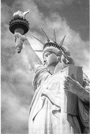
Industries needed workers and many of them came from overseas. New York City was port of entry for most newcomers. In the 1890s and early 1900s millions of them sailed past the Statue of Liberty in New York harbor on the way to a fresh start in the US. Today New York ranks as the nation’s largest city, a financial and a cultural center for the US and the world.
The South
If all regions of the US differ from one another, the South could be said to differ most. Perhaps the basic difference between the South and other regions is geographic. This region was once described as a land of yellow sunlight, clouded horizons and steady haze. The first Europeans to settle this region were, as in New England, mostly English Protestants. However, few of them came to America in search of religious freedom. Most of them were looking for the opportunity to farm the land and live in reasonable comfort. Their early way of life resembled that of English farmers. Most farming was carried out on single family farms, but some settlers grew wealthy by raising and selling tobacco and cotton. In time they established large farms, called plantations, which required the work of many laborers. African slaves, shipped by the Spanish, Portuguese and English, supplied labor for these plantations. These slaves were bought and sold as property.
Even after the North began to industrialize in the 800s, the South remained agricultural. The economic interests of the manufacturing North became divergent from those of the agricultural South. Economic and political tensions began to divide the nation and eventually led to the Civil War (1861 – 1865). When the South finally surrendered in 1865 it was forced to accept many changes during the period of Reconstruction.
In the first half of the 20th century coastal sections of Florida and Georgia became vacation centers for Americans from other regions. In cities such as Atlanta and Memphis the population soared. The South was booming as never before.
Recent statistics show that the South differs from other regions in a number of ways. Southerners are more conservative, more religious and more violent than the rest of the country. Because fewer immigrants were attracted to less industrialized Southern states, Southerners are the most “native” of any region. Most black and white Southerners can trace their ancestry in this country back to before 1800s. Southerners tend to be more mindful of social rank and have strong ties of hometown and family.

|
Из за большого объема этот материал размещен на нескольких страницах:
1 2 3 4 5 6 7 8 9 10 11 12 13 14 15 |
